Green Quarter - Lake District Walk
Wednesday 28th March 2012
The last day of our holiday was another hot and sunny day. We wanted for a shorter walk that was on our route home and so we headed for Kentmere. We has also hoped that as it was mid-week and not in the school holidays we wouldn't struggle to find a parking place. A previous attempt to do this walk had to be abandoned as we couldn't find a parking space.
Start: Kentmere (NY 4561 0410)
Route: Kentmere - Green Quarter - Hollow Moor on Green Quarter Fell (349) - Cocklaw Fell (350) - Green Quarter - Kentmere
Distance: 5.25 miles Ascent: 351 metres Time Taken: 3 hours 35 mins
Terrain: A mixture of good paths and tussocks.
Weather: Hot and sunny.
Pub Visited: The Duke William, Stavely Ale Drunk: Shepherd Neame, Spitfire

Having successfully found a parking space we head for the hamlet of Green Quarter.

Climbing above Green Quarter, Sallows and Yoke come into view.

As we climb higher the view of the Kentmere Horseshoe keeps improving.

As we leave the track and head towards a gate, to gain access to Green Quarter Fell, Shipman Knotts comes into view.

Having clambered over a locked gate we eventually found the stile that gave us access to the summit of Hollow Moor on Green Quarter Fell.

The summit of Hollow Moor appears to be marked by this old stone post.

The GPS and our eyes suggested it wasn't actually the summit, instead this grassy mound appeared to be the actual summit.

Looking into Upper Kentmere from the summit.

It was just about possible to pick out Kentmere Reservoir with our eyes but much easier to find zooming in with the camera.

Looking towards the ridge running from Shipman Knotts to Harter Fell.

After retracing our steps back to the stile we headed round and across a rather damp patch of ground to the summit of Cocklaw Fell, where we got our closest view of Skeggles Water. The original plan had been to head down to it but after all of the tramping through tussocks to gain this summit we decided to leave it for another day.

Cocklaw Fell was another fell that seemed to have several different possible summits. This stone marks one of the possible summits.

This small mound is another contender for the summit, if the GPS is to be believed.

Whichever is the summit, they all offered a good view across Longsleddale to Bannisdale Fell.

Here looking up towards the head of Longsleddale and Branstree.

We decided to reverse our route to the summit and headed back through the tussocks and marshy ground to pick up the good track we had crossed earlier. Not a walk I would fancy doing in summer when the tussocks aren't so easy to spot.
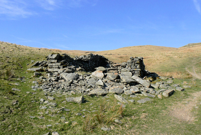
Following the clear track back to Green Quarter we passed this ruin. Looking at other people's walks in this area there was once a more substantial ruin than this one, either I missed that one or it has collapsed or been raided for stones recently.

Following the clear track we soon find ourselves back into the Kentmere Valley with views across to Sour Howes and Sallows, two of the Birkett summits we did before I set up the website. In fact we ended up doing them when we first tried to do this walk and couldn't park in Kentmere.

Kentmere seems a long way, especially as our legs are starting to let us know they weren't really up to four days of back-to-back walks.

Never mind, the views are good and it is all downhill.

Back down on the valley floor and stopping to admire the reflections in the river.

All that remains is that incline back up to the car which is by the church and the drive home.
All pictures copyright © Peak Walker 2006-2023